Saturday, 10 November 2012

Tikkakoski nature trail

Tikkakoski is located about 20 km north from Jyväskylä and it is best known for its close connection to aviation: it is the location of Jyväskylä's airport, Aviation Museum of Central Finland and home to Finnish Air Force Academy. However, I don't plan to be walking in the air but firmly on the ground, along Seitsemän kukkulan luontopolku (Seven Hills Nature Trail) which starts in the neighbourhood of Air Force Academy, at the beginning of Luonetjärventie road.
There is a notice board by the side of the parking lot but it seems to offer information on anything else but the nature trail: Moped driving prohibited! An ad for a local driving school. Cross-country skiing instructions. When you're allowed to go skiing with your dog on the ready-made tracks (No kidding! Mon & Wed between 8 and 10 pm! Obviously, there needs to be snow.).
It is no use to look at a map of cross country skiing tracks if you all you want to know is where the nature trail begins. I have to resort to my cell phone and search for the map of Seitsemän kukkulan luontopolku online to see where exactly the path is supposed to start. OK, only a couple of meters from where I'm standing. Right.
As the trail is named after "seven hills" I must be standing on the very first one now - at least the path leads down from here. The bright sunshine promises a nice walk in the forest but very soon I hear a distinct noise coming from the left.
The trail marks lead me to a narrow road. A quad bike whizzes past. And then another one. The first signpost says that the land in this area is pretty worn because of lots of activities. As I follow the red trail marks along the same tracks that the quad bikes take turns to ride I think that my own footprints may not be equal to those of the tyre marks... Again I hear the engine roar and step aside, to give way to the guys on wheels.
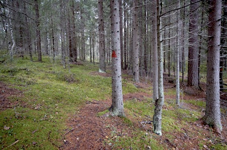
I must admit that I am relieved to see the trail turn off the wide track because the quad bikes aren't attempting to take this trail. The ground becomes level and I enter a small marsh. A signpost reminds me that cuckoos are typical inhabitants in areas like this. At this time of the year you can't however hear the cuckoo calling in Finland. They have left us for a warmer climate for the winter.
The path follows a pine bog and guides me to a narrow channel of still water that reflects the pines growing on its shores. Thanks to the duckboards it is possible to keep your feet dry when walking here.
In an instant the marsh turns to extremely dry land: there are sandy ridges on my right. I listen carefully and can't hear the quad bikes anymore. Perhaps they have left their perfect, peaceful training ground for the day. Thank you!
The route marks steer me towards a narrow track, off the gravel road and again to the side of a pine bog with few trees. It is actually interesting to see the scenery change so much within such a short distance - from dry to very wet land and back.
I can't help looking around for mushrooms; it would be great to find some to take home with me. I'm not extremely lucky and find only few but at least there is an abundance of lingonberries growing in the woods before they get hit by the cold weather. If only I had a cup or something with me to pick some berries!
Oh no, this doesn't look too good. How come those pines have fallen exactly on the path? However, there is nothing to worry about because you only need to take a couple of steps to the right to see the trail continue intact a bit further.
Along the trail, there are a couple of signs that remind that this area is a nature reserve since 1981 (when Tikkakoski was not yet part of Jyväskylä city) and it is used by schools for learning about geography and biology. No rubbish. No disturbing the nature. I try to step very carefully over the lichen to keep them intact.
The trail is descending slightly so this must be one of the "hills" of the "Seven Hills' Trail". All this while, I've been looking forward to a sign that would explain why on earth the trail got its grand name. To me, the little hillocks don't necessarily deserve to be called hills.
The weather has already turned cloudy when I arrive at the quiet Mustalampi lake, surrounded by marshland. There is a small resting spot with two wooden benches right on the shore, overlooking the lake. I learn that it is possible to meet red-throated divers (in Finnish: 'kaakkuri') in little lakes just like this.
On the shores of Mustalampi it is at first slightly wet, then very wet. Again, I thank the duckboards for keeping my feet dry!
It is so late in the autumn that the birches have lost their leaves already; the dry leaves are turning from yellow to brown before they become one with the earth. The green moss seems to offer the only bright colour in the scenery before I spot the blue and white stripes on some trees. They indicate that I am now very close to Luonetjärvi Air Force base.
Next, I step onto a small road and see a swamp right in front of me but no trail signs. Which way to go? Left? Right?
After a moment of hesitation, I check the forest on my left and see another route mark. The trail continues along the edge of the marsh before turning right into it, on the wobbly-looking duckboards that are actually some kind of a narrow bridge across a shallow pond. No handrails. And the duckboards are seriously leaning to my right. I don't want to slide into the pond, walking on damp pieces of wood!
Once I'm almost halfway across the duckboards I give up. Better be safe than sorry! I want to have a good look around me and kneel down. Much better. The grass, leaves and their reflections are simply works of art, created accidentally on the surface or beneath it. Despite enjoying the moment I think the duckboards could perhaps be straightened, making it easier to cross the pond. Oh well, it is easy to walk round the water to the other side if you don't want to risk it.
Next, I arrive at a spruce forest. To my eyes, the area around the path has mostly been surrounded by pine trees so this is something different, if only for a while.
There are lots of paths running in different directions in the forest, yet it is easy to stay on the right track. Quite a few other people are enjoying the area on foot here also, either jogging or walking. I can well imagine that this place is full of people cross-country skiing in the winter. A forest always beats asphalt tracks that run next to busy roads.
When I arrive at the next sign that tells about the landscape I am not surprised to find it tells about suppa, a large 'hole' in the esker which was formed by a large block of ice during the ice age. That is exactly what is in front of me.
The last sign tells about the smallish treeless bog, in Finnish neva. It looks like my boots would definitely sink in if I went walking there to see if there are any cranberries growing there. From here the trail climbs slightly uphill, to the top of the ridge and I find I've walked a full circle. There's still one question in my mind: which hillocks have been upgraded to hills to give a name to this trail? Need to get a detailed map to find out about that... 

Friday, 2 November 2012

Central Finland Provincial Trail: Pyhä-Häkki - Tulijärvi

It is early Friday evening at Pyhä-Häkki national park gate at Saarijärvi, Central Finland. The parking lot is deserted except for my vehicle until another car stops there for a couple of minutes and then leaves after checking out the place - nothing to see here now? I pick up my backpack and have a look at the route map. There should be about 2 hours of daylight left. 
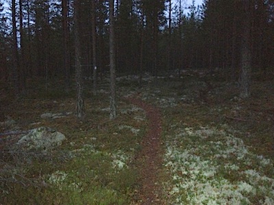
I choose to follow the Tulijärvi trail, marked with white paint. It will eventually take me to Central Finland Provincial Trail's blue trail marks that also lead to the northwest, towards Kannonkoski. It is only a couple of weeks since I followed the very same path in the opposite direction when hiking from Saarijärvi to Pyhä-Häkki. I soon arrive from the forest to Riihineva marshland.
Riihineva marsh opens wide and is as quiet as can be. I can only hear my own footsteps against the dry, grey duckboards. No need to step aside and let others pass... There isn't even a bird in sight.
Just before the "paved" trail changes to a regular footpath it reminds me that this season has been rather wet. I really hope that any duckboards ahead won't be very wet because walking on slimy wood would make my progress pretty slow especially after dark.
Leaving the open land behind, I continue along the worn, wide path. Numerous hikers have taken this route before me, most of them on a day trip in the national park. Quite a few rocks have been uncovered underneath their feet...
I stop to admire the red peat moss by the path. Even if most colours in the nature are fading at this time of the year, with the leaves already having mostly fallen down and getting brown, the moss isn't giving up. Besides, its shape reminds me of Africa.
A small brook meanders under the trees, as silent as it can. I feel like I am the loudest creature alive in the forest, hearing the rustle of my jacket and goretex pants. Perhaps the other creatures around me don't think so.
As it such a short while since I last walked this very same route, albeit in the opposite direction, it feels a bit funny to be here so soon again. Of course, passing a route once doesn't necessarily make it familiar ground. At the next marsh, I wonder about the straight channel right next to the duckboards - until I realize that it must be where the duckboards were at some point previously, until it became too wet.
Tall fir trees tower above me. I reach the signposts that I was looking for: it will be only 3.2 kilometres' walk to Tulijärvi shelter. This is good news because it isn't dark yet which means that at least part of the way will be easy to hike.
On the left side of the path I get a glimpse of Kotajärvi lake. Last time I stopped at the other end of the lake where it is possible to make a fire - there is plenty of firewood. As it is so late in the day there is no point in making even the tiniest detour and have a snack. It is such a small distance to Tulijärvi, after all!
There are quite a few tall, barkless snags by the side of the path. So many forests these days are commercial forests where you can practically never see them so I feel priviledged to meet so many right here. 
Walking in these woods left to grow wild is so easy that you could call this a luxury. The ground is flat and it would be easy to walk anywhere without a path underneath my feet. In my mind I compare this to the (worst) commercial forests which have met their end at final felling. Replanting after that usually requires manual work but many forest owners prefer to use machinery as much as possible. With mounding, the landscape changes most because it means that an excavator scoops a hole in the ground and the seedling is planted on top of the mound next to the hole. Add to that the tree stumps, branches etc. left to rot and the area is very easily unwalkable for a long time. Compared to that, this is a paradise.
The route continues marked with white paint and blue ribbons, although I am leaving behind the Pyhä-Häkki national park. The blue ribbon confirms that I am on Central Finland Provincial Trail towards the north. It seems that light is beginning to fade slowly.
Whether the reason is the fading light or something else that distracts me but for some reason I don't open my map here and automatically follow the "stronger" trail, turning to the left. It is so easy to see that Pyhä-Häkki national park is behind me because my (untrained) eyes spot enduro motorcycle marks on the ground. Without them, the path would be excellent but the tyres have made the trail muddy.
What is this? Another National Park sign at the sharp bend? Wait a minute... Finally, I take out my map and realize I should have continued along another trail and not turn here. However, there are also white paint marks on the trees so this is a bit confusing. Sigh. I won't bother to turn back because I will be able to rejoin the Tulijärvi trail very soon if I just continue walking.
In the fading light, I follow the path straight to Rahelampi pond, my boots sinking into the soft mossy ground by the shore. Just a quick view before getting back to the proper trail; again I meet a Pyhä-Häkki national park signpost. I turn back, take a sharp turn left and follow a path close to the shore. Seeing the white trail marks descending from the right in the distance is a lovely sight - I am once again back on the trail.
The path takes me through heather-covered ground and I am thankful for the trail being marked with white paint which is very easy to spot in the dark even without wearing a headlamp. The next sign reveals that I have walked about 5 kilometres from Pyhä-Häkki and it's only 18 kilometers to Kannonkoski, the next village. That would be tomorrow, right?  In the dusk, the narrow path reaches a road and I meet the next trail sign. Only 0.5 kilometers to Tulijärvi shelter. Almost there!
I walk down a tiny road and guess that my destination is only few steps away although I can hardly see a thing. A headlamp is indeed a necessity at this time of the day - or night. I've spent the last two kilometers wondering if there are any others at the shelter and how great it will be to make a fire there...  The shelter looks pretty good and I take off my backpack. Next: make a fire. However, an unpleasant surprise is waiting for me - there is absolutely no firewood in the shed. This is a first for a long time! The guest book reveals that I'm not the only one who has experienced the same... 

I switch off my headlamp and start adjusting my eyes to the darkness. After a while I start to discern something, but it is already so dark that it is impossible to see the lake Tulijärvi right next to me unless I go to the shore. It is ironic. After all, the lake and the shelter bear the name Tulijärvi - tuli means fire. Fireless lake, I would say! What should I do? I don't fancy spending a night here without a fire. Unfortunately that means... A walk back to the car at Pyhä-Häkki.

Darkness surrounds me as I walk back to the nearest road. I could return via the same path but I choose to take a different, slightly longer route (7-8 km) instead, walking along the roads. It will be easier now that there is so little light. Suddenly I see a light flash on my right, in the direction of the path that I took to come here. Apparently there are one or two other hikers approaching the Tulijärvi shelter. Hope they will enjoy it more than I did! I switch off my headlamp and walk fairly briskly in the dark, under few stars, passing only few houses on the solitary road. A different Friday night anyway; it seems that I'll continue along the Central Finland Provincial Trail to Kannonkoski another time :)

Wednesday, 31 October 2012

Järvenpää Culture Trail

I take a couple of steps towards the pedestrian street from Järvenpää railway station and ask what is the distance to Ainola, the former home of composer Jean Sibelius which is nowadays a museum. The answer is approximately 15 minutes' walk which doesn't sound too bad. Admittedly, I have a gut feeling that Ainola will not be open but it should be possible to get a glimpse of it anyhow. I take the pedestrian street towards lake Tuusulanjärvi and then turn left to Sibeliuksenväylä, a road named after the master. A huge flock of birds is flying across the lake. For them it is time to leave Finland for somewhere warm.
After passing the fields on both sides of the road, the first buildings on the right belong to Seurakuntaopisto (Church Training College) after which I spot a sign that indicates there is a tourist attraction on the right. The yellow building at the end of the road is Ahola, the former home of writer Juhani Aho. The poster on the noticeboard quotes Aho's words:  Varmaan olen enemmän kalamies kuin kirjamies (I bet I'm more of a fisherman than a writer). Either Juhani Aho was being modest or he must have been a truly fantastic fisherman.
Ahola was home to the writer and his artist wife Venny Soldan-Brofeldt in 1897-1911. They were a remarkable artistic couple with an unconventional marriage. It would be great to learn more about their life here but unfortunately the museum is only open from May to September. Better luck next time.
I return back to Sibeliuksenväylä which has already taken me very close to Ainola; I can already see where it is. Aho family was friends with the Sibelius family and they really lived within a stone's throw of each other. From Poikkitie road I turn to Ainolankatu street which leads me to the now closed gates of Ainola which Sibelius named after his beloved wife Aino. October seems to translate for winter: also Ainola will open next time in May. Only the coffee shop Aulis on the grounds is kept open during the winter season, weekends only.
I had hoped to get a good look of the house from the gates but the house remains hidden behind the trees. A thick spruce fence protects Ainola but perhaps I could get a glimpse of the main building somewhere behind the corner?  Jean Sibelius and his family moved to Ainola in 1904. I am sure they didn't have as much privacy behind such a fence back then.
Moving further I discover I remembered right and the tall spruces do not totally block the view to the house. You can at least see the roof and a bit of the top floor. Of course this doesn't equal to a view of the whole house and garden but it is something.
So far there have been only few drops of rain so I decide to walk just a little bit further. At a short distance from the fence surrounding Ainola there is a little sign, neatly framed. Surprise - it tells about Ainola! Another surprise - I am actually on Järvenpää Culture Trail (Järvenpään kulttuuripolku) which I never even knew existed. The signs are only in Finnish, though.
Järvenpää Culture Trail was created back in 1995 which may explain why the signs are somewhat worn and the texts have faded in the sun. The trail isn't even marked with paint or symbols; basically you just need to walk from a historically important building / area to another following a circular route upon which I happened to stumble. However, it is very easy to find your way because the area is very flat and you can almost see your next destination from the previous signpost. Lippumäki ('Flag Hill')  is an area on the left side of the path which seems to have rich history if you recognize the names of the artists or other cultural figures who have lived here. Unfortunately it is very difficult to spot the buildings mentioned in the description of the area, even though the leaves have almost fallen down.
On the other side of the footpath there is a pretty house which may or may not be an important part of the cultural heritage of the area. However, there is no story about this one on the trail.
When I arrive at old and narrow Ristinummi village road, I can just about see Pekka Halosen akatemia where you can study art, photography and graphic design. The school was named after artist Pekka Halonen who lived very close by - only 2 km from the current academy; however, his former home (nowadays a museum just like Ainola) isn't part of Järvenpää Culture Trail because Halosenniemi happens to be located in the neighbouring community Tuusula. Ristinummi area was home to Tilly Soldan who had a relationship with writer Juhani Aho. Who happened to be married to Tilly's sister Venny. Venny was quite a character: she welcomed also the child born of this relationship to Ahola. Apparently she wasn't a very jealous person.
The culture trail follows the village road for a short while before arriving at Kallio-Kuninkala and its grounds where there are quite a few buildings. The most impressive one is the main building called Ylä-Kuninkala, built in the early 1920's for Paloheimo family. Currently, Kallio-Kuninkala is home to music: the Sibelius Academy organizes courses and concerts here.
These days, Kallio-Kuninkala is owned by Leonora and Yrjö Paloheimo Foundation. The first owner of the estate was nationalist and businessman  K.A. Paloheimo (Karl Alfred) whose memorial can be found on the lawn; the sculpture Hengen liekkikruunu, or Flame Crown of Spirit was sculpted by Erkki Eronen (1978).
I descend from the main building to the lower part of the garden. The red and yellow Ala-Kuninkala was originally in Karelian Isthmus (in Finnish: Karjalan Kannas) but it was transferred from there first to Syväranta by lake Tuusulanjärvi and later, in 1918, right here.
I recognize a familiar shape in the garden. I suppose the painting Kullervo goes to war by Akseli Gallén-Kallela is well inscribed in my memory... However, this artwork is not by Gallén-Kallela but forged by an anonymous artist.
The garden of Kallio-Kuninkala is still partly under renovation, including the man-made pond which is not even half full. Time to start returning to Järvenpää; I leave the garden through a jugend style gate and head towards the footpath by the side of lake Tuusulanjärvi.
Lake Tuusulanjärvi is only a couple of meters from the road. I can't resist the temptation but step across the grass and take a deep breath by the still lake on this early evening. It is so beautiful.
Right behind me the road towards Järvenpää is fairly busy, unlike the quiet trail that I followed earlier. I need to keep my eyes turned towards the lake, the fields, the autumn colours and forget about the traffic noise.
Soon I reach the last marked destination of Järvenpää Culture Trail (there was no trail sign at Ahola but actually, it is part of the trail...). The sign is almost hidden among the rose bushes and perhaps just a little bit too far from the footpath. Suviranta (1901) is also well hidden, again mostly behind a dense spruce fence which doesn't offer a chance to have a very good look at the building which seems very nice on the photograph. Suviranta was the home of artist Eero Järnefelt, a realist painter who was very much inspired by nature.
Suviranta is still owned by the same family but unlike Ahola or Ainola, it is not a museum and thus can rarely be visited. The best bet is probably to attend a local music festival Meidän festivaali, or Our festival in the summer; some concerts are held here. I look across the road to my right - there is Ainola, the Sibelius family home. I have come almost full circle already.
The Culture Trail behind me, I get back to Järvenpää centre. On the way there you just can't miss this artwork in Ystävyydenpuisto (Friendship Park): the huge yellow sculpture Kolmisointu by U.S. artist Rolf Westphal (1979). Every time I pass this I can't help but think this is an (anti) ad for a certain fast food chain, with the letter 'M' somewhat rearranged, taking a stroll in the park...