Showing posts with label hiking trail. Show all posts

Friday, 2 November 2012

Central Finland Provincial Trail: Pyhä-Häkki - Tulijärvi

It is early Friday evening at Pyhä-Häkki national park gate at Saarijärvi, Central Finland. The parking lot is deserted except for my vehicle until another car stops there for a couple of minutes and then leaves after checking out the place - nothing to see here now? I pick up my backpack and have a look at the route map. There should be about 2 hours of daylight left. 
I choose to follow the Tulijärvi trail, marked with white paint. It will eventually take me to Central Finland Provincial Trail's blue trail marks that also lead to the northwest, towards Kannonkoski. It is only a couple of weeks since I followed the very same path in the opposite direction when hiking from Saarijärvi to Pyhä-Häkki. I soon arrive from the forest to Riihineva marshland.
Riihineva marsh opens wide and is as quiet as can be. I can only hear my own footsteps against the dry, grey duckboards. No need to step aside and let others pass... There isn't even a bird in sight.
Just before the "paved" trail changes to a regular footpath it reminds me that this season has been rather wet. I really hope that any duckboards ahead won't be very wet because walking on slimy wood would make my progress pretty slow especially after dark.
Leaving the open land behind, I continue along the worn, wide path. Numerous hikers have taken this route before me, most of them on a day trip in the national park. Quite a few rocks have been uncovered underneath their feet...
I stop to admire the red peat moss by the path. Even if most colours in the nature are fading at this time of the year, with the leaves already having mostly fallen down and getting brown, the moss isn't giving up. Besides, its shape reminds me of Africa.
A small brook meanders under the trees, as silent as it can. I feel like I am the loudest creature alive in the forest, hearing the rustle of my jacket and goretex pants. Perhaps the other creatures around me don't think so.
As it such a short while since I last walked this very same route, albeit in the opposite direction, it feels a bit funny to be here so soon again. Of course, passing a route once doesn't necessarily make it familiar ground. At the next marsh, I wonder about the straight channel right next to the duckboards - until I realize that it must be where the duckboards were at some point previously, until it became too wet.
Tall fir trees tower above me. I reach the signposts that I was looking for: it will be only 3.2 kilometres' walk to Tulijärvi shelter. This is good news because it isn't dark yet which means that at least part of the way will be easy to hike.
On the left side of the path I get a glimpse of Kotajärvi lake. Last time I stopped at the other end of the lake where it is possible to make a fire - there is plenty of firewood. As it is so late in the day there is no point in making even the tiniest detour and have a snack. It is such a small distance to Tulijärvi, after all!
There are quite a few tall, barkless snags by the side of the path. So many forests these days are commercial forests where you can practically never see them so I feel priviledged to meet so many right here. 
Walking in these woods left to grow wild is so easy that you could call this a luxury. The ground is flat and it would be easy to walk anywhere without a path underneath my feet. In my mind I compare this to the (worst) commercial forests which have met their end at final felling. Replanting after that usually requires manual work but many forest owners prefer to use machinery as much as possible. With mounding, the landscape changes most because it means that an excavator scoops a hole in the ground and the seedling is planted on top of the mound next to the hole. Add to that the tree stumps, branches etc. left to rot and the area is very easily unwalkable for a long time. Compared to that, this is a paradise.
The route continues marked with white paint and blue ribbons, although I am leaving behind the Pyhä-Häkki national park. The blue ribbon confirms that I am on Central Finland Provincial Trail towards the north. It seems that light is beginning to fade slowly.
Whether the reason is the fading light or something else that distracts me but for some reason I don't open my map here and automatically follow the "stronger" trail, turning to the left. It is so easy to see that Pyhä-Häkki national park is behind me because my (untrained) eyes spot enduro motorcycle marks on the ground. Without them, the path would be excellent but the tyres have made the trail muddy.
What is this? Another National Park sign at the sharp bend? Wait a minute... Finally, I take out my map and realize I should have continued along another trail and not turn here. However, there are also white paint marks on the trees so this is a bit confusing. Sigh. I won't bother to turn back because I will be able to rejoin the Tulijärvi trail very soon if I just continue walking.
In the fading light, I follow the path straight to Rahelampi pond, my boots sinking into the soft mossy ground by the shore. Just a quick view before getting back to the proper trail; again I meet a Pyhä-Häkki national park signpost. I turn back, take a sharp turn left and follow a path close to the shore. Seeing the white trail marks descending from the right in the distance is a lovely sight - I am once again back on the trail.
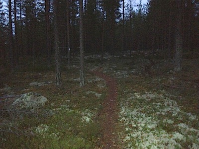
The path takes me through heather-covered ground and I am thankful for the trail being marked with white paint which is very easy to spot in the dark even without wearing a headlamp. The next sign reveals that I have walked about 5 kilometres from Pyhä-Häkki and it's only 18 kilometers to Kannonkoski, the next village. That would be tomorrow, right?  In the dusk, the narrow path reaches a road and I meet the next trail sign. Only 0.5 kilometers to Tulijärvi shelter. Almost there!
I walk down a tiny road and guess that my destination is only few steps away although I can hardly see a thing. A headlamp is indeed a necessity at this time of the day - or night. I've spent the last two kilometers wondering if there are any others at the shelter and how great it will be to make a fire there...  The shelter looks pretty good and I take off my backpack. Next: make a fire. However, an unpleasant surprise is waiting for me - there is absolutely no firewood in the shed. This is a first for a long time! The guest book reveals that I'm not the only one who has experienced the same... 

I switch off my headlamp and start adjusting my eyes to the darkness. After a while I start to discern something, but it is already so dark that it is impossible to see the lake Tulijärvi right next to me unless I go to the shore. It is ironic. After all, the lake and the shelter bear the name Tulijärvi - tuli means fire. Fireless lake, I would say! What should I do? I don't fancy spending a night here without a fire. Unfortunately that means... A walk back to the car at Pyhä-Häkki.

Darkness surrounds me as I walk back to the nearest road. I could return via the same path but I choose to take a different, slightly longer route (7-8 km) instead, walking along the roads. It will be easier now that there is so little light. Suddenly I see a light flash on my right, in the direction of the path that I took to come here. Apparently there are one or two other hikers approaching the Tulijärvi shelter. Hope they will enjoy it more than I did! I switch off my headlamp and walk fairly briskly in the dark, under few stars, passing only few houses on the solitary road. A different Friday night anyway; it seems that I'll continue along the Central Finland Provincial Trail to Kannonkoski another time :)

Friday, 14 September 2012

Central Finland Provincial Trail: Vuosjoki-Pyhä-Häkki

I wake up to a lovely, crispy morning at Vuosjoki shelter. It is nice to finally see where I am, after having arrived here in the dark the previous night. I can hear the Vuosjoki brook right beside me. A nice place for a breakfast outside!
I fill my water bottle with fresh water from Vuosjoki brook. Originally, the weather forecast promised rain for today but there is no sign of rain at all. Alright, I'll continue further north as I hoped to do. The trail signs say Saarijärvi 9.5, Pyhä-Häkki 22. I don't think I'll go any further than that.
The first leg of the journey is about 8 kilometres. It feels so good to walk in daylight through the pine forest. Compared to previous night, there is no doubt about which way the trail will go. I encounter a felling, the first of its kind by the path, and soon a jogger who is accompanied by a friendly puppy. They've been running on the trail and he tells me that they've seen nobody else this morning. It is going to be a solitary walk, it seems.
As usual, the Central Finland Provincial Trail alternates between narrow footpaths and dirt roads, with an occasional hand-made warning sign for cars. I'm sure they are for the briskly moving cross country skiers, not for hikers...
The path becomes temporarily a little wider when it crosses an old field. It seems that an ATV has passed through here. The last of the bluebells are still in bloom.
A small anthill is surrounded by a dense mat of lingonberries as if by a huge garland.  The terrain changes to heathland, and there are more large rocks scattered here and there. I arrive at the start of a dirt road but can't see trail marks at first - except to a side path that leads to Kekkilä which is not my destination. A quick look at the map however confirms that I need to turn to the left for Pyhä-Häkki.
Soon I am accompanied by warm sunlight; the nature is smiling with me while the autumn colours get even brighter. I follow the dirt road for a long time before arriving by lake Kouranjärvi which offers a great place for a bit of rest either inside a kota shelter or sitting in the sun outside.
The picturesque lake Kouranjärvi is very quiet and there is hardly any wind. Koura means 'hand' or 'palm', perhaps something else as well. The shape of the lake doesn't remind me of a hand, though.
At lake Kouranjärvi the path runs very close to the shore and the duckboards make sure that you don't sink your boots into the wet moss. I stop often to eat some blueberries although their taste is not at their best anymore; their best season has been over for some time now.
Saarijärvi 18, Pyhä-Häkki 13. It seems that I am progressing pretty fast, thanks to the well kept route. However, there is still enough time to gaze at the lovely nature around me. Even little things such the colourful leaves on the ground by the path. The duckboards - of which there are plenty - are sometimes a bit slippery so that is a good enough reason to slow down as well.
Another bog, then another dirt road and for a while I can't spot any trail signs or blue paint. However, I keep walking straight ahead and after a while a sign confirms that I'm still on the right track. Quite a bit of felling has been done in this area.
Finally, I arrive at Tiilikka which has been advertised in the trail signs ever since Saarijärvi. Just like in the earlier places, there is firewood available, wooden benches and a shelter. And a well with a hand pump - a chance to fill my water bottle again! Right next door is the large Tiilikka hut which seems like a place that is rented out to groups.
The signs guide me through the front yard of Tiilikka hut to the pine forest. There seems to be an art exhibition of a kind with some strange wooden artwork scattered about, but no information whatsover about the display. Mysterious.
After some more blueberries and winding paths, I find myself very close to Pyhä-Häkki: only 6.5 km to go! If I were clever enough, I would either pay attention to the little symbols on the signs or take a good look at my map. But no. I simply read Pyhä-Häkki and follow the sign, although I had planned to take the shortest path to a certain place at Pyhä-Häkki national park. The shortcut goes via Poika-aho hut, 0.6 km from here... But I end up following the route marked primarily for cross-country skiers... Anyway, it is not much longer.
For a while, I see very few blue paint marks and instead start spotting blue ribbons tied to the trees. The way to mark skiing routes, yes. It doesn't matter, this route will anyway take me to Pyhä-Häkki. There are a couple of deer flys - not many for which I am grateful - but I ignore them and stop to admire the beautiful red rocks next to the path.
Ah, lingonberries. Again. You are not just pretty, but delicious! Just what a hiker needs on a long day.
As the path winds downhill I arrive at the sign of Pyhä-Häkki National Park, one of the smallest national parks in Finland. Finally, nature in its natural habitat and no felled trees.
The pine forest behind me, I meet aged duckboards that are almost covered with soft moss. It seems that not too many hikers follow this trail in the summertime, and when you are skiing, the duckboards are somewhere beneath the snow anyway. The bogland is simply beautiful.
The forests of Pyhä-Häkki allow you to see old trees that you may seldom meet in regular forests. There are e.g. tall pine trees that are hundreds of years old - a rare sight indeed in Finland.
Meandering among the ancient trees is like walking in a fairytale. This is what the woods used to look like before commercial forests were invented. The signs ahead announce: Kannonkoski 25, Kotajärvi 2.7.  I turn left to follow the path that leads to Kotajärvi lake, marked with red and white paint dots on the trees. I totally forget that I was supposed to follow the blue paint for Central Finland Provincial Trail but who cares...
Walking the wide, well-kept paths at Pyhä-Häkki is easy. First up a small hill, then down - and in front of me opens an almost majestic sight: a crowd of proud, tall pine trees and total peace. The path leads me down to Kotaneva mire and its long duckboards. I say hello to the two hikers who are going to spend a night at the nearby Poika-aho hut (available for rent) and they tell me that there were some people at Kotajärvi, grilling sausages by the fire, only a little while ago. I'd better hurry - I've got some sausages with me!
I arrive at a deserted, still Kotajärvi lake. Unfortunately for me, the other hikers I just met on the path must have been the ones grilling sausages earlier - and they were responsible people who extinguished the fire before leaving the place. The ashes are still warm.  Oh well, it is getting late so I decide not to make a new fire but instead walk on, to the National Park gate and parking lot before everyone has left the park for today.
There are quite a few trails in Pyhä-Häkki National Park, each colour-coded. I choose the green route to make a little detour to Riihineva mire, to enjoy the open bogland once more.
Riihineva may get even more beautiful as the autumn matures but for me the scenery with its soft colours looks fantastic already. I have now walked for more than 6 hours but don't feel any rush to get away. However, I have a little transportation issue ahead...
Although the weather is still great, I need to leave the next part of the Central Finland Provincial Trail for another time; should have packed a bit more food in my backpack. The trail between Saarijärvi and Pyhä-Häkki was in good condition and it was marked alright, if not always very well.
My arriving at the gate of Pyhä-Häkki National Park late in the afternoon leaves me with a little problem: it is about 22 km back to Saarijärvi via the road. The parking lot is practically deserted so there seems to be no chance of asking for a lift from someone, and there is no bus service available. I start walking the straight road. Luckily, after about 40 minutes of walking on the asphalt, the fourth car that passes me by stops and gives me a lift. Thanks for the driver for making an exception - because it looked like it was going to rain!

Tuesday, 11 September 2012

Central Finland Provincial Trail: Saarijärvi-Vuosjoki

It is Friday night at Saarijärvi, Central Finland. There is still a bit of daylight left - for an hour or two at best. I pick up my backpack and turn to the road north towards Kannonkoski to follow Central Finland Provincial Trail, once again. A faded sticker Keski-Suomen Maakuntaura on a lamp post confirms that I'm on the right track.
This time I'm using a map that's not too detailed; the scale of Pohjoisen Keski-Suomen luontoreitistöt (Central Finland nature routes) is 1:100 000 so I can't see exactly which lane to follow to the hiking trail which is somewhere on my left. There are a couple of blue trail marks painted along the footpath so I stick to it until I reach the lake Pieni-Lumperoinen. I guess I'd better take a left now and head up to Heramäki hill.
The first part of the walk takes me past a peaceful suburb close to Heramäki footpath where a blue dot reveals that the trail goes right here. However, I decide to make a private shortcut through a patch of forest to the official trail. Don't ask me why. Just to get a feel of the terrain...
Very soon I hit the marked trail which can't be missed; although the path itself is just a regular footpath, there is a wide opening between the trees. Why? In the wintertime, this becomes a cross country skiing track.
According to Luonnonvoimaa.net website, the Central Finland Provincial Trail is marked north of Saarijärvi so I hope that will help me also when the darkness falls. This is a test! The blue paint marks on the trees are a promising sign. It feels weird that summer is really turning to autumn already, with the leaves changing colour from green to yellow. Very soon I hit a proper trail sign (Saarijärvi / Tiilikka) and learn that although my real destination is not Tiilikka, that is the way to follow.
The leaves on the trees are not the only ones changing their colours. It is early stages yet but you can already spot some ruska, which is the word in Finnish that describes the wonderful world of autumn colours. Willow herbs are slowly turning flaming red. However, there's also something edible that's red right at my feet: lingonberries! They taste so good.
I keep an eye on mushrooms as well but either someone has just been here to pick all the edible ones or I'm just not lucky. Anyway, I had better walk briskly and not step off the path too much tonight.
Narrow footpaths in the forest are my absolute favourites but this time I truly appreciate the trail being used also as a skiing track. It means that it will be easier to see where the trail goes also when it gets darker, and not so easy to take a wrong turn.
Some raindrops hit my face when I enter an opening where trees have been felled some years ago.  I fold the map back into my pocket and put on the hood. It will surely be just a small shower but the more there are clouds, the sooner it will get dark...
The trail crosses a dirt road, gets back to the forest, hits another opening and leads me past the thin, tall spruces. Again, a dirt road, into the woods, and suddenly I realize that darkness begins to fall. For real.
There are more and deeper shadows around me and I tread more carefully. Hello, headlamp, you'd better come out. Can't read the map without it anymore. And where have all the trail marks gone? I don't know exactly where I am, thanks to the map's scale, but have a pretty good idea anyway. Should I take a left or a right? I'd love to catch a sight of a blue trail mark, really!

After a moment's hesitation, I make my choice. The willow herbs are making fun of me. You think this is a path? It is, actually. On my left, there are some lights from nearby houses, good, and... A spot of blue paint on a birch. Thank you. It seems that the rest of the hike tonight will be an interesting one!
The silence around me is comforting although I am surrounded by deepening darkness. For a while, I keep the headlamp switched on but sometimes I switch it off, wishing to adjust to the dark and to see how well I can manage without a light on.
There are no stars yet and unfortunately also the moon is in hiding - just when its help would be appreciated. However, for some reason it is not that difficult to be walking along the path although I can hardly see it. It is a matter of taking it easy, stepping softly. I arrive at a small wooden bridge and glance at the dark water beneath my feet. It doesn't look unfriendly. Then there's a ditch to cross before arriving at a crossroads. Right or left? Even the headlamp doesn't shed enough light to this; I can't find a trail sign.Well, well, well.
Let's take out the compass and make sure that I choose the right direction. After about half kilometre, I finally spot a routemark. Thank you! Tiilikka - see you later, perhaps.

It is both fun and exciting to be traipsing all alone in the strange woods at night. I remember certain nights from my teenage years and roaming the woods with other scouts, and always finding the way to the place where we were to camp for the night. Why shouldn't I find the way now. My eyes get more and more used to the darkness and I can discern the straight route also with the help of the gap between the treetops.

Suddenly I see a flash of light far ahead. I instinctively switch off my headlamp - what, are there other people? - and stop to listen. There is only silence. It was just a car passing by. However, for the remainder of the path I choose to walk in the darkness, preferring to arrive by the road unannounced.
The Vuosjoki shelter is only about half a kilometre away, close to the road that leads to Kannonkoski village. I continue to walk in the dark and only light my headlight when arriving at the wooden bridge over Vuosjoki brook, right by the shelter.
There is nobody else at Vuosjoki. There is plenty of firewood. There is shelter for the night. I hear a distant shot or two echo in the dark; there are also hunters about, but not in the immediate vicinity because they will be by a lake instead for the wild ducks. I make a fire and have a snack. Should I stay or should I go - back to Saarijärvi? The starry night above me gives me a clear answer: stay. After all, it will be nice to see this place in the daylight! Glad I took a sleeping bag with me, just in case...